[{"id":465836704039,"handle":"cincinnati-gift-guide-1","updated_at":"2026-06-07T07:00:25-04:00","published_at":"2023-11-24T09:22:44-05:00","sort_order":"manual","template_suffix":"","published_scope":"global","title":"Cincinnati Gift Guide","body_html":"Get 30% off everything in our Cincinnati Series until Monday, November 27."},{"id":517828051239,"handle":"oops-all-zombies","title":"Oops All Zombies","updated_at":"2026-07-24T07:00:25-04:00","body_html":"\u003cp\u003eGet 30% off all our Zombie merchandise through Monday, June 8 at 11:59pm EST!\u003c\/p\u003e","published_at":"2026-06-03T14:32:53-04:00","sort_order":"manual","template_suffix":"","disjunctive":true,"rules":[{"column":"tag","relation":"equals","condition":"zombie"},{"column":"tag","relation":"equals","condition":"zombies"},{"column":"title","relation":"contains","condition":"zombie"},{"column":"title","relation":"contains","condition":"living dead"},{"column":"title","relation":"contains","condition":"zombies"}],"published_scope":"global"},{"id":9328650,"handle":"11-x-17-inch-prints","updated_at":"2026-07-24T07:00:25-04:00","published_at":"2013-03-04T13:56:28-05:00","sort_order":"alpha-asc","template_suffix":null,"published_scope":"global","title":"Prints","body_html":"","image":{"created_at":"2013-03-04T13:56:29-05:00","alt":null,"width":1500,"height":971,"src":"\/\/alternatehistories.com\/cdn\/shop\/collections\/Memphis1.jpg?v=1362423389"}},{"id":170218029142,"handle":"all","title":"Products","updated_at":"2026-07-25T07:00:31-04:00","body_html":null,"published_at":"2020-06-12T11:30:32-04:00","sort_order":"alpha-asc","template_suffix":null,"disjunctive":false,"rules":[{"column":"type","relation":"not_equals","condition":"mw_hidden_cart_fee"},{"column":"type","relation":"not_equals","condition":"Product Fee"},{"column":"type","relation":"not_equals","condition":"mw_product_option"},{"column":"type","relation":"not_equals","condition":"mw_motivator_product"},{"column":"type","relation":"not_equals","condition":"mw_product_option_cloned"}],"published_scope":"global"},{"id":1260060681,"handle":"rust-belt","title":"Rust Belt","updated_at":"2026-07-24T07:00:25-04:00","body_html":"","published_at":"2017-10-15T18:21:02-04:00","sort_order":"best-selling","template_suffix":null,"disjunctive":true,"rules":[{"column":"tag","relation":"equals","condition":"Pittsburgh"},{"column":"tag","relation":"equals","condition":"Cleveland"},{"column":"tag","relation":"equals","condition":"Detroit"},{"column":"tag","relation":"equals","condition":"Ohio"},{"column":"tag","relation":"equals","condition":"ann arbor"},{"column":"tag","relation":"equals","condition":"Cincinnati"},{"column":"tag","relation":"equals","condition":"Columbus"}],"published_scope":"global"}]
This handsome 11 x 17 inch print is printed on real, authentic paper, and comes with this description of a fine Ohio city:
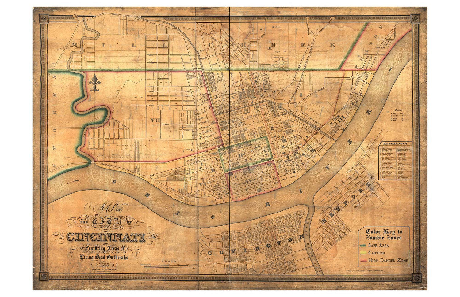
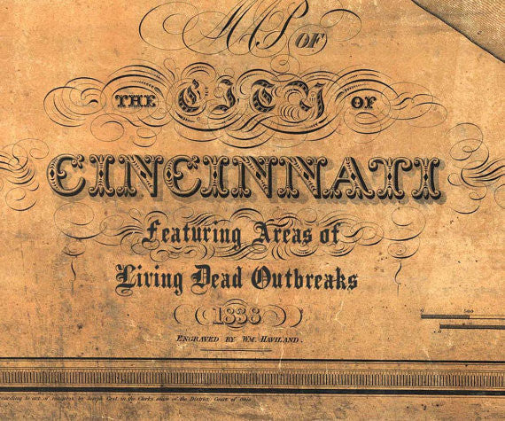
This hand-tinted map of Cincinnati dates from approximately 1838 and includes a remarkable about of detail about the initial construction of the city. The descriptions of the neighborhoods as “Color-Coded Zombie Zones” refers to the war-like status of the battle between the citizens of Cincinnati and the flesh-eating, shambling denizens of the night.
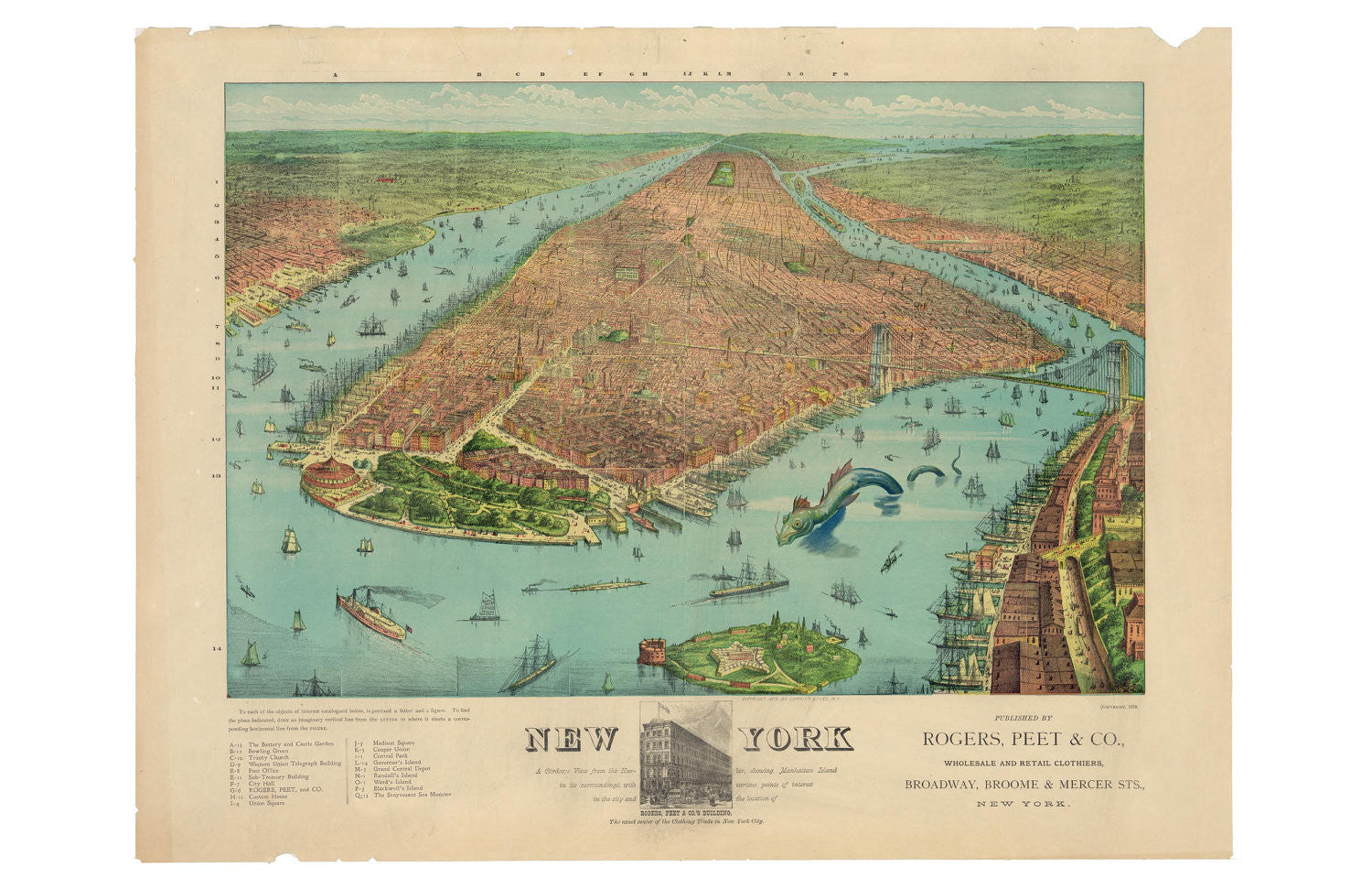
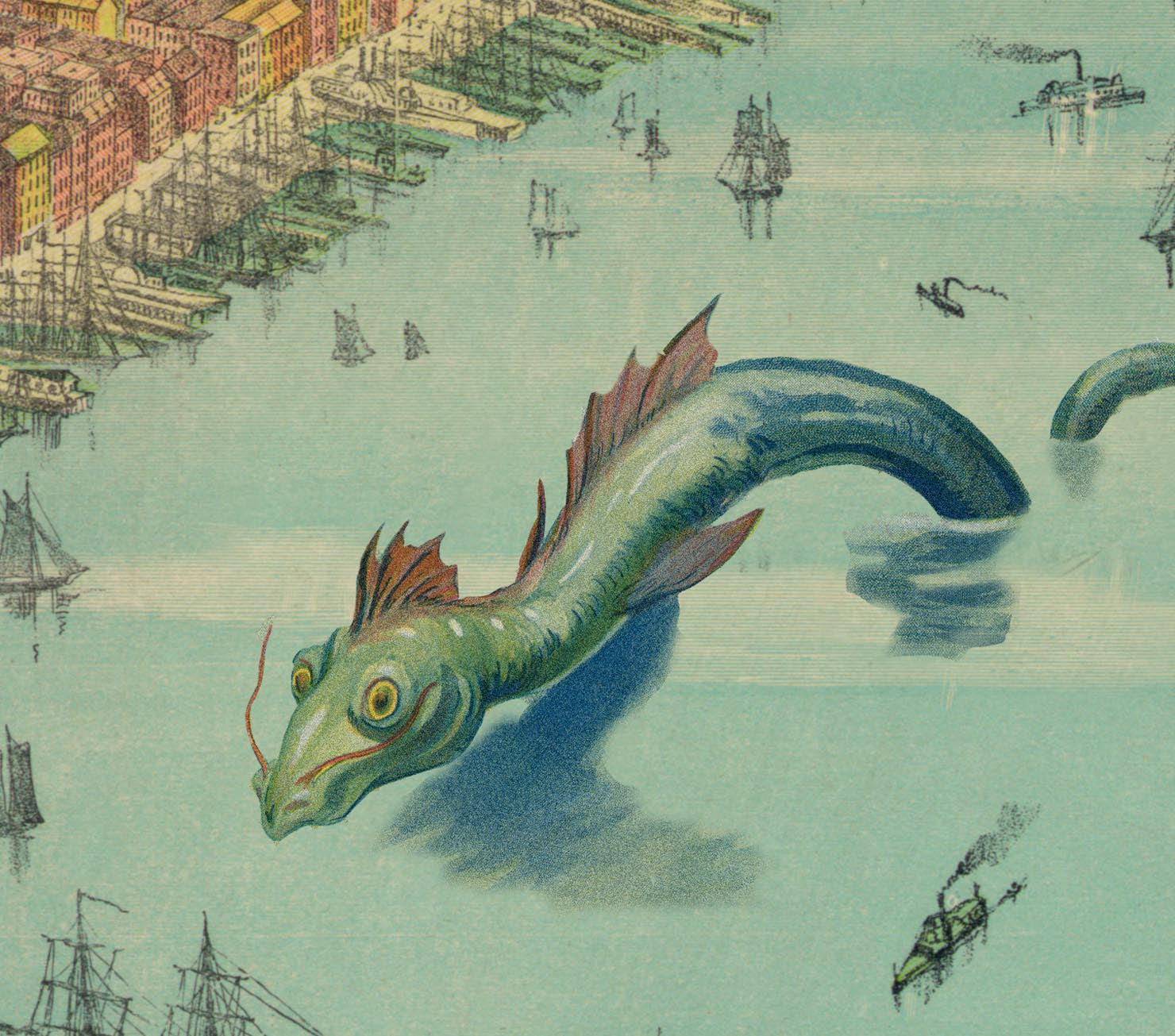
What fine old knickerbocker wouldn't be happy to have this 11 x 17 map hanging on their wall? Comes with this description: Rogers, Peet, & Co. produced this wonderfully colorful...
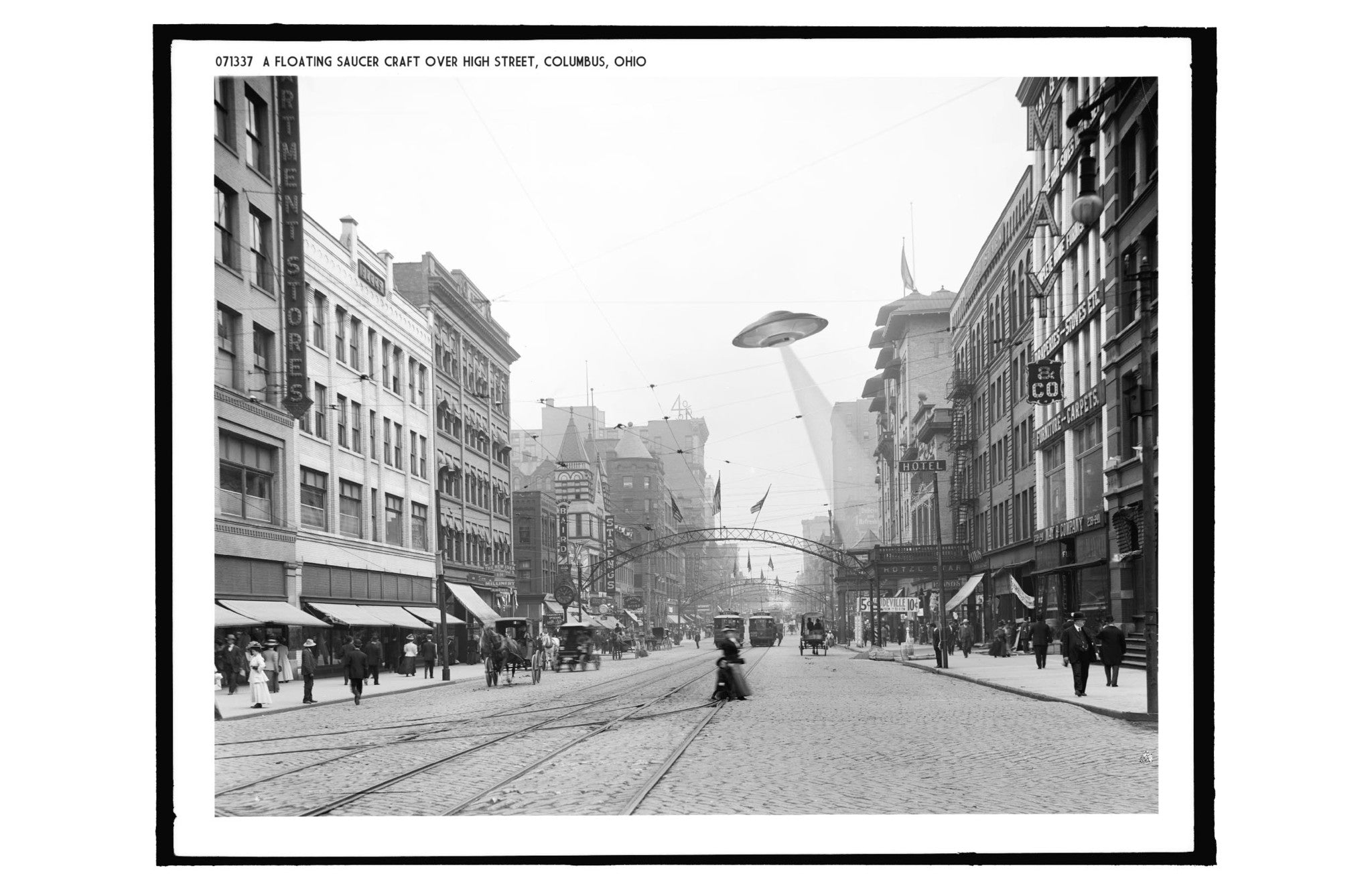
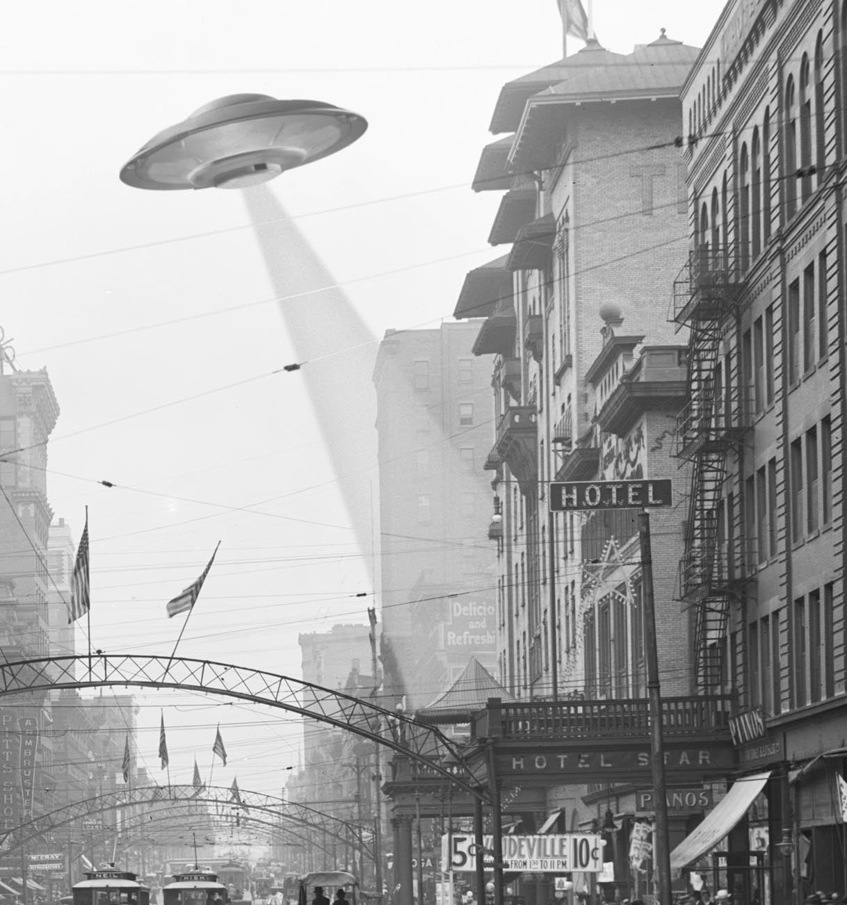
Ah, High Street! Jewel of Columbus, center of commerce and industry! Home to UFOs! Comes with this description: "1905, Columbus Ohio: The down-town area of Columbus Ohio bustled with activity...
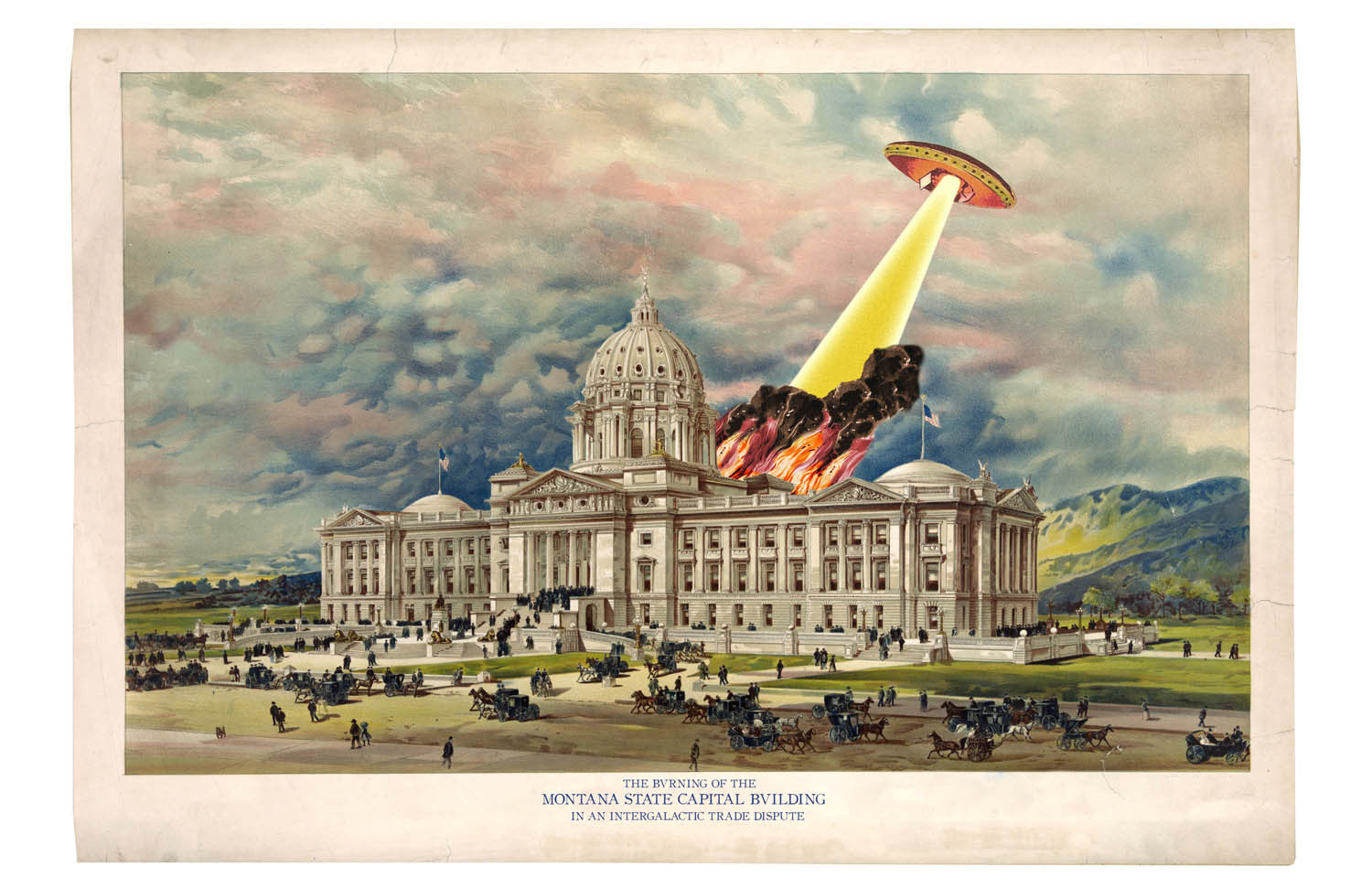
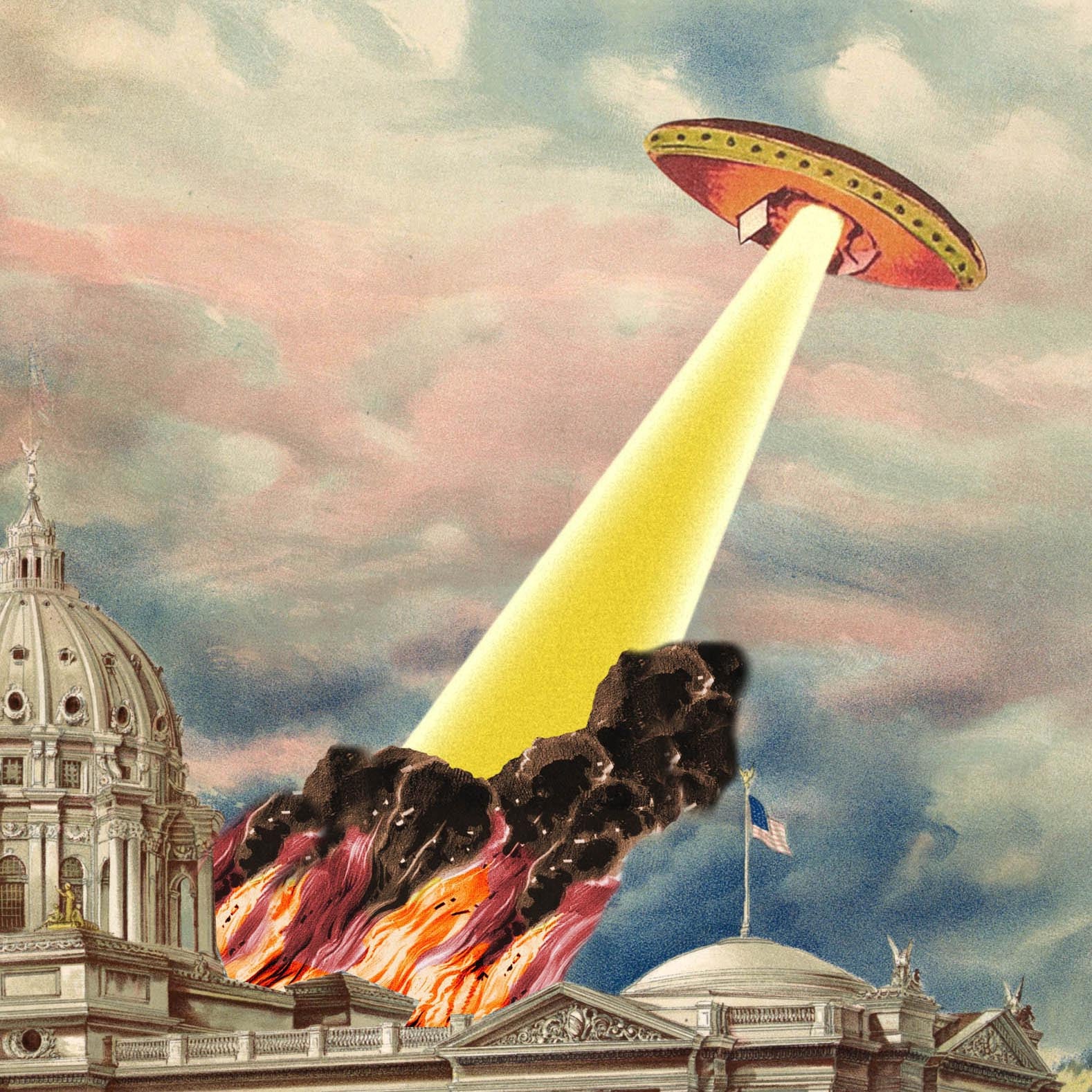
The beautiful capitol dome in Helena, Montana shines light a beacon in this beautiful print, handsomely light up by flames and smoke from a flying saucer attack. Those pesky flying...