[{"id":1260748809,"handle":"east-coast","title":"East Coast","updated_at":"2026-06-29T07:00:24-04:00","body_html":"","published_at":"2017-10-15T19:02:40-04:00","sort_order":"alpha-asc","template_suffix":"","disjunctive":true,"rules":[{"column":"tag","relation":"equals","condition":"new york"},{"column":"tag","relation":"equals","condition":"Pennsylvania"},{"column":"tag","relation":"equals","condition":"Delaware"},{"column":"tag","relation":"equals","condition":"maryland"},{"column":"tag","relation":"equals","condition":"washington dc"},{"column":"tag","relation":"equals","condition":"new jersey"},{"column":"tag","relation":"equals","condition":"Connecticut"},{"column":"tag","relation":"equals","condition":"Massachusetts"},{"column":"tag","relation":"equals","condition":"rhode island"},{"column":"tag","relation":"equals","condition":"Vermont"},{"column":"tag","relation":"equals","condition":"new hampshire"},{"column":"tag","relation":"equals","condition":"maine"}],"published_scope":"global"},{"id":517828051239,"handle":"oops-all-zombies","title":"Oops All Zombies","updated_at":"2026-07-06T07:00:29-04:00","body_html":"\u003cp\u003eGet 30% off all our Zombie merchandise through Monday, June 8 at 11:59pm EST!\u003c\/p\u003e","published_at":"2026-06-03T14:32:53-04:00","sort_order":"manual","template_suffix":"","disjunctive":true,"rules":[{"column":"tag","relation":"equals","condition":"zombie"},{"column":"tag","relation":"equals","condition":"zombies"},{"column":"title","relation":"contains","condition":"zombie"},{"column":"title","relation":"contains","condition":"living dead"},{"column":"title","relation":"contains","condition":"zombies"}],"published_scope":"global"},{"id":9328650,"handle":"11-x-17-inch-prints","updated_at":"2026-06-29T07:00:24-04:00","published_at":"2013-03-04T13:56:28-05:00","sort_order":"alpha-asc","template_suffix":null,"published_scope":"global","title":"Prints","body_html":"","image":{"created_at":"2013-03-04T13:56:29-05:00","alt":null,"width":1500,"height":971,"src":"\/\/alternatehistories.com\/cdn\/shop\/collections\/Memphis1.jpg?v=1362423389"}},{"id":170218029142,"handle":"all","title":"Products","updated_at":"2026-07-06T07:00:29-04:00","body_html":null,"published_at":"2020-06-12T11:30:32-04:00","sort_order":"alpha-asc","template_suffix":null,"disjunctive":false,"rules":[{"column":"type","relation":"not_equals","condition":"mw_hidden_cart_fee"},{"column":"type","relation":"not_equals","condition":"Product Fee"},{"column":"type","relation":"not_equals","condition":"mw_product_option"},{"column":"type","relation":"not_equals","condition":"mw_motivator_product"},{"column":"type","relation":"not_equals","condition":"mw_product_option_cloned"}],"published_scope":"global"}]
Home
/
Products
/
Washington D.C. and the Living Dead
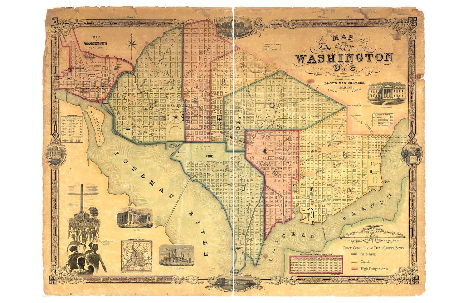
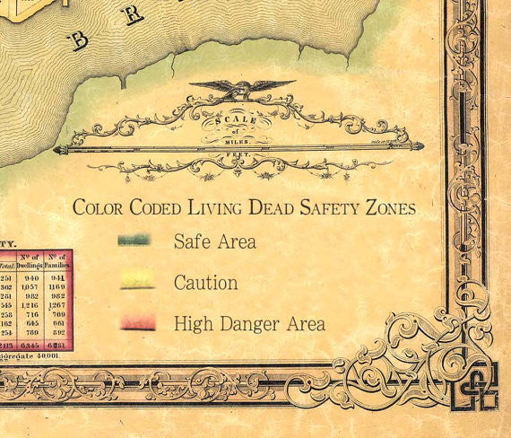
Washington D.C. and the Living Dead
$20.00
Stay safe in your travels to our nation's Capitol with this 11 x 17 inch map of Zombie safe areas!
Comes with this description: This hand-colored map of the District of Columbia dates from approximately 1851 and includes a remarkable about of detail about the initial construction of the city. The descriptions of the neighborhoods as “Color-Coded Safety Zones” refers to the war-like status of the battle between the citizens of Washington and the flesh-eating, shambling denizens of the night.
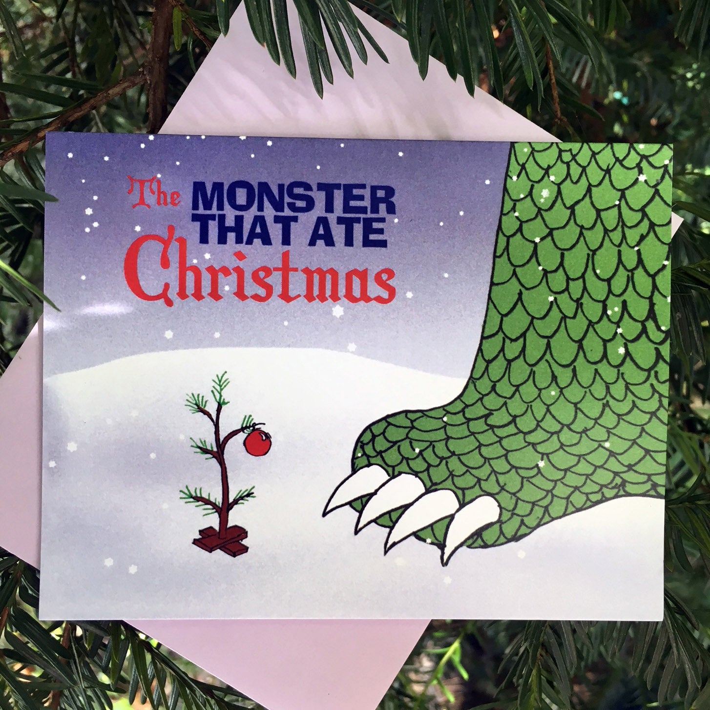
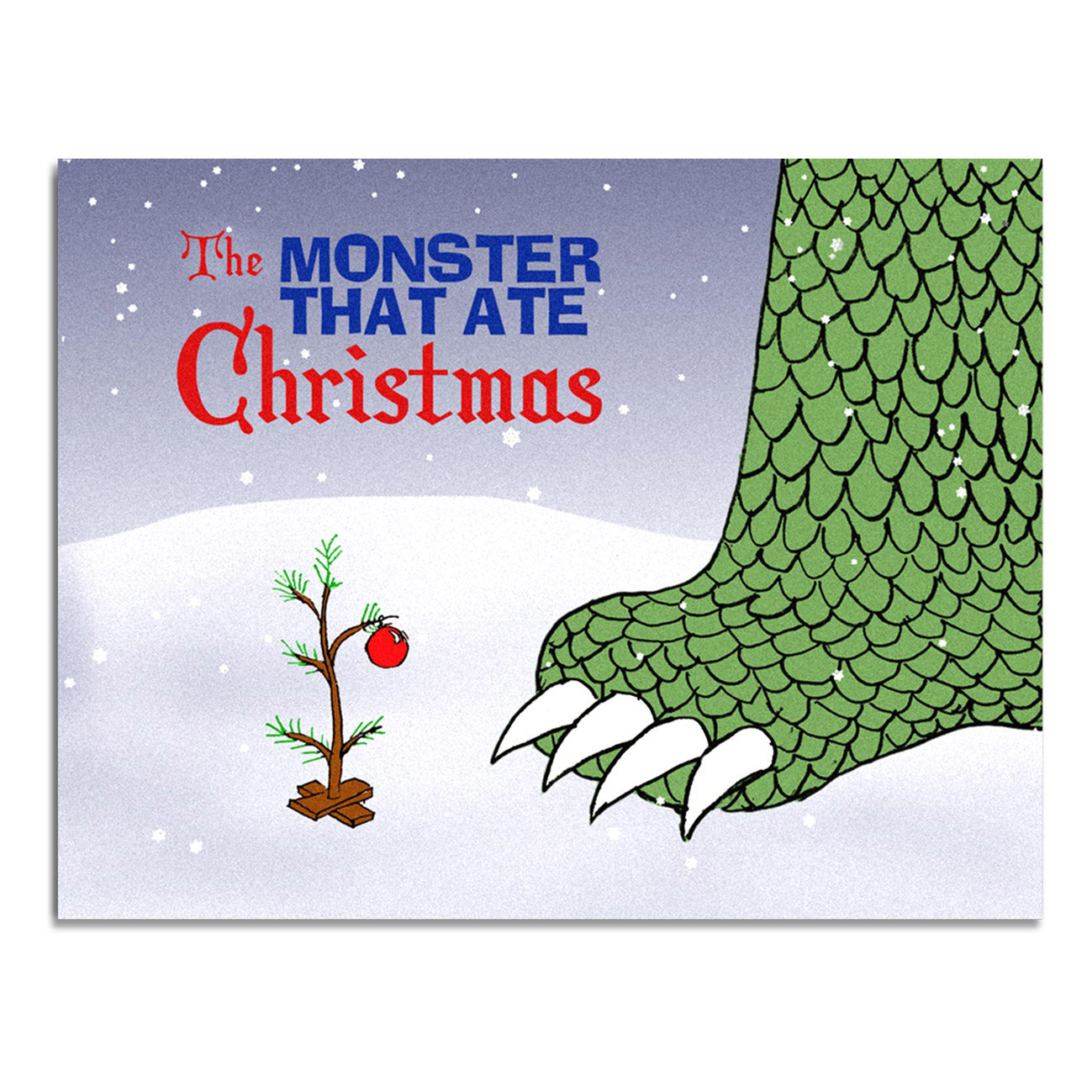
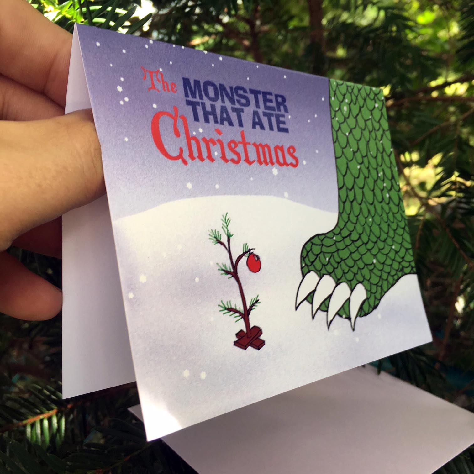
"Christmas time / is here / Monsters do / we fear" - ah who doesn't love that classic refrain from the annual special "The Monster that Ate Christmas"? My favorite...
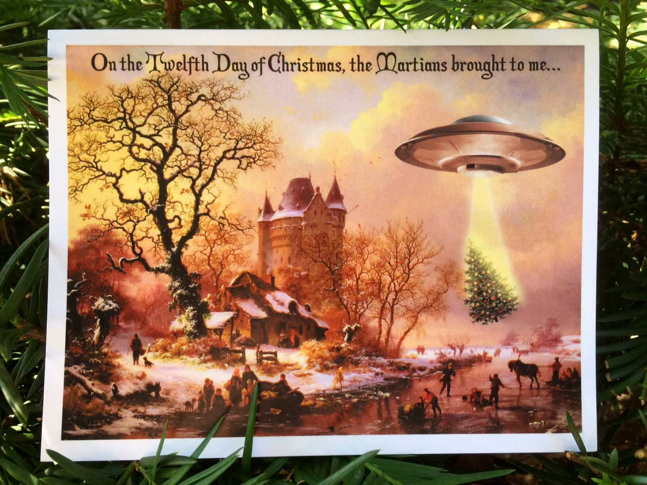
Not all aliens are bad! Some Martians are helpful, like this one delivering a Christmas tree on the twelfth day of Christmas! Share some holiday humor with your friends this...
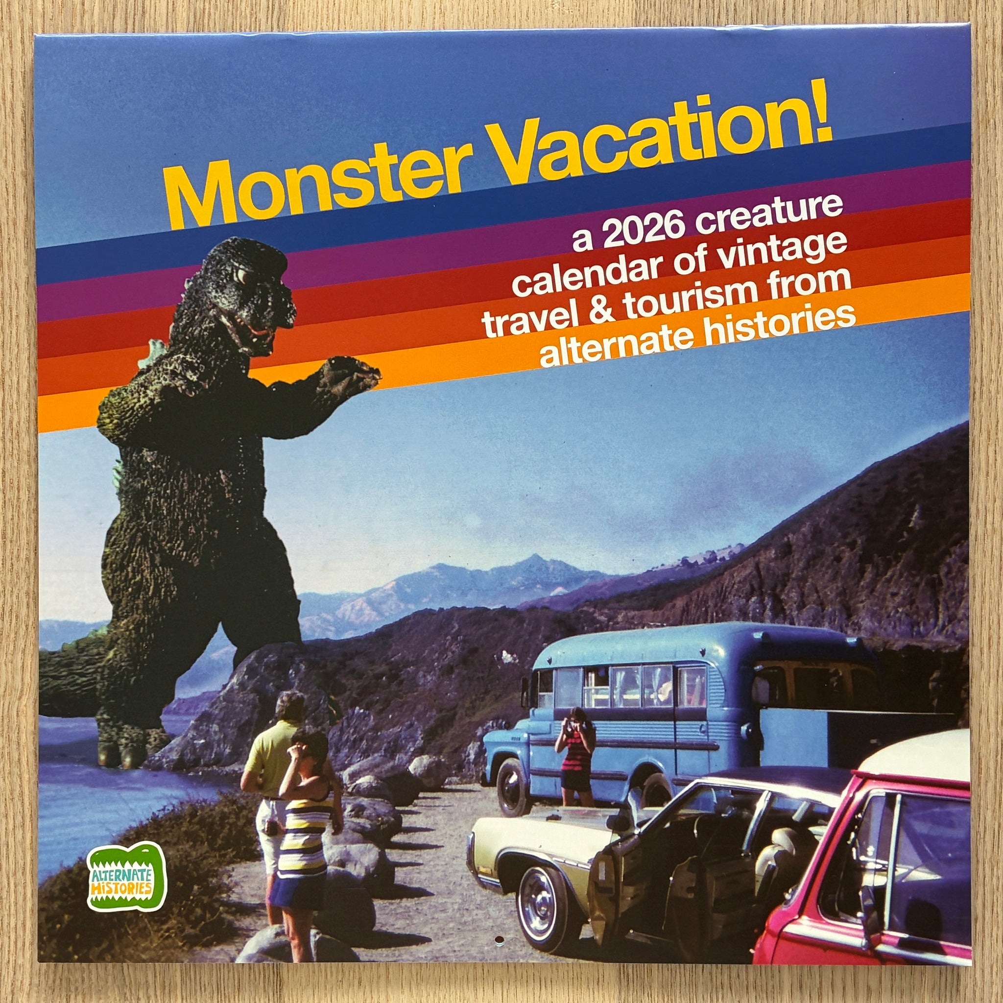
Real vintage photos, fake monsters! After digging into a collection of 35mm slides from family trips across the country, I’ve created the ultimate collection of vacation photos, with appearances from...